Professional Mapping Solutions
Advanced geospatial mapping services powered by cutting-edge technology and unmatched expertise
Mapping Services
From topographic surveys to advanced 3D modeling, we deliver precision mapping solutions for every project need
Detailed terrain and elevation mapping for engineering and construction projects.
- Contour mapping
- Digital elevation models
- Terrain analysis
- Survey-grade accuracy
Property boundary mapping and land ownership documentation services.
- Property boundaries
- Legal descriptions
- Subdivision planning
- Title support
Comprehensive mapping of utilities, roads, and municipal infrastructure.
- Utility mapping
- Asset management
- Network analysis
- Maintenance planning
Advanced 3D visualization and modeling for complex spatial analysis.
- Point cloud processing
- Mesh generation
- Volume calculations
- Virtual reality
Interactive online mapping solutions and geospatial web applications.
- Interactive maps
- Data visualization
- Custom applications
- API integration
Field data collection and mobile mapping solutions for real-time operations.
- Field collection
- Offline capabilities
- Real-time sync
- GPS integration
Featured Projects
Discover our successful mapping projects across diverse industries and applications
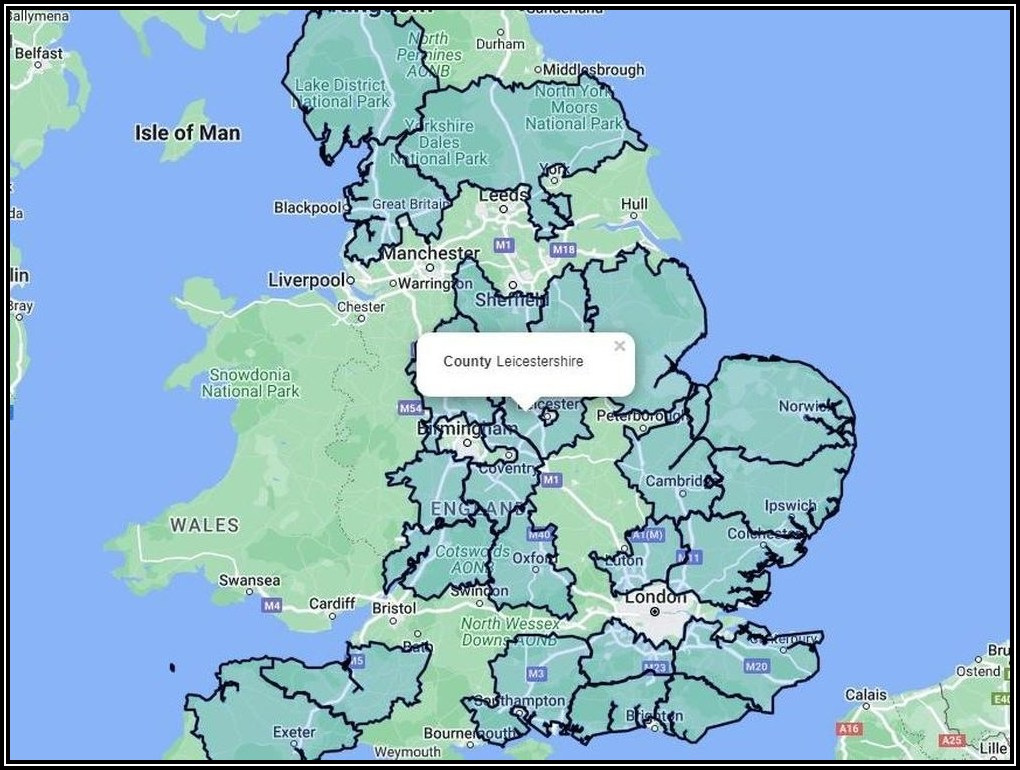 Administrative
England County Boundary Mapping
Local Government Agency
A comprehensive mapping project to digitize and visualize the county boundaries of England for administrative and planning purposes.
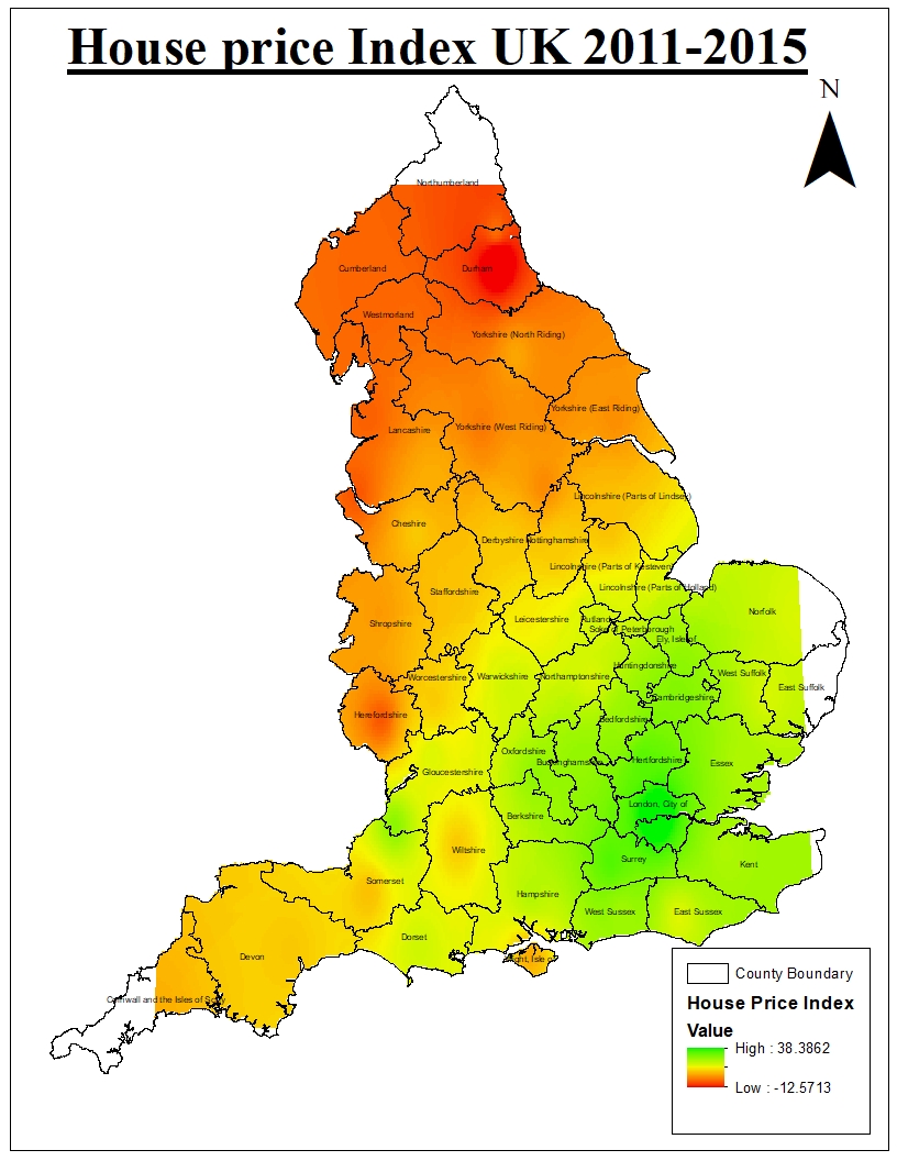 Real Estate
UK Housing Price Index Heatmap
Financial Analytics Firm
Developed a dynamic heatmap visualization of the UK's Housing Price Index (HPI) to show regional value trends and identify investment opportunities.
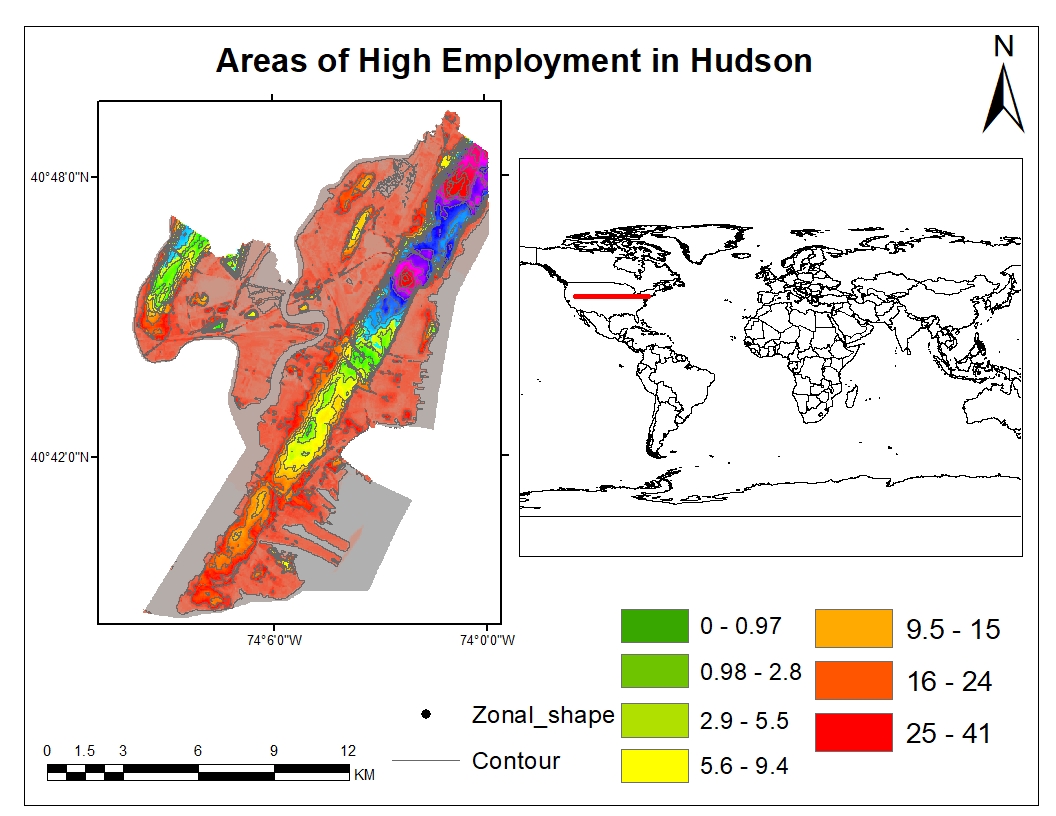 Economic Development
High Employment Area Analysis
Economic Development Council
Geospatial analysis to identify and map areas with high employment rates, providing valuable insights for urban development and economic policy planning.
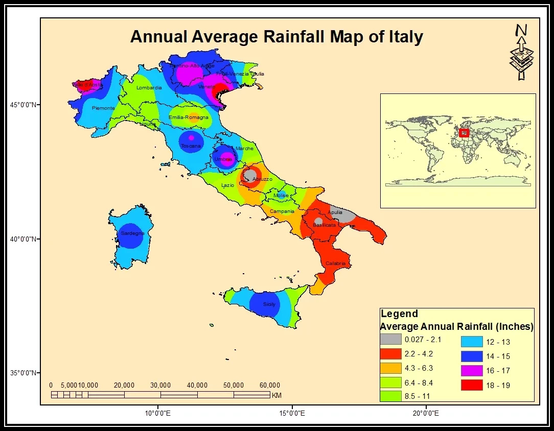 Agriculture & Environment
Italy Annual Rainfall Mapping
Agricultural & Environmental Group
A detailed choropleth map illustrating the average annual rainfall across Italy, essential for agricultural planning and water resource management.
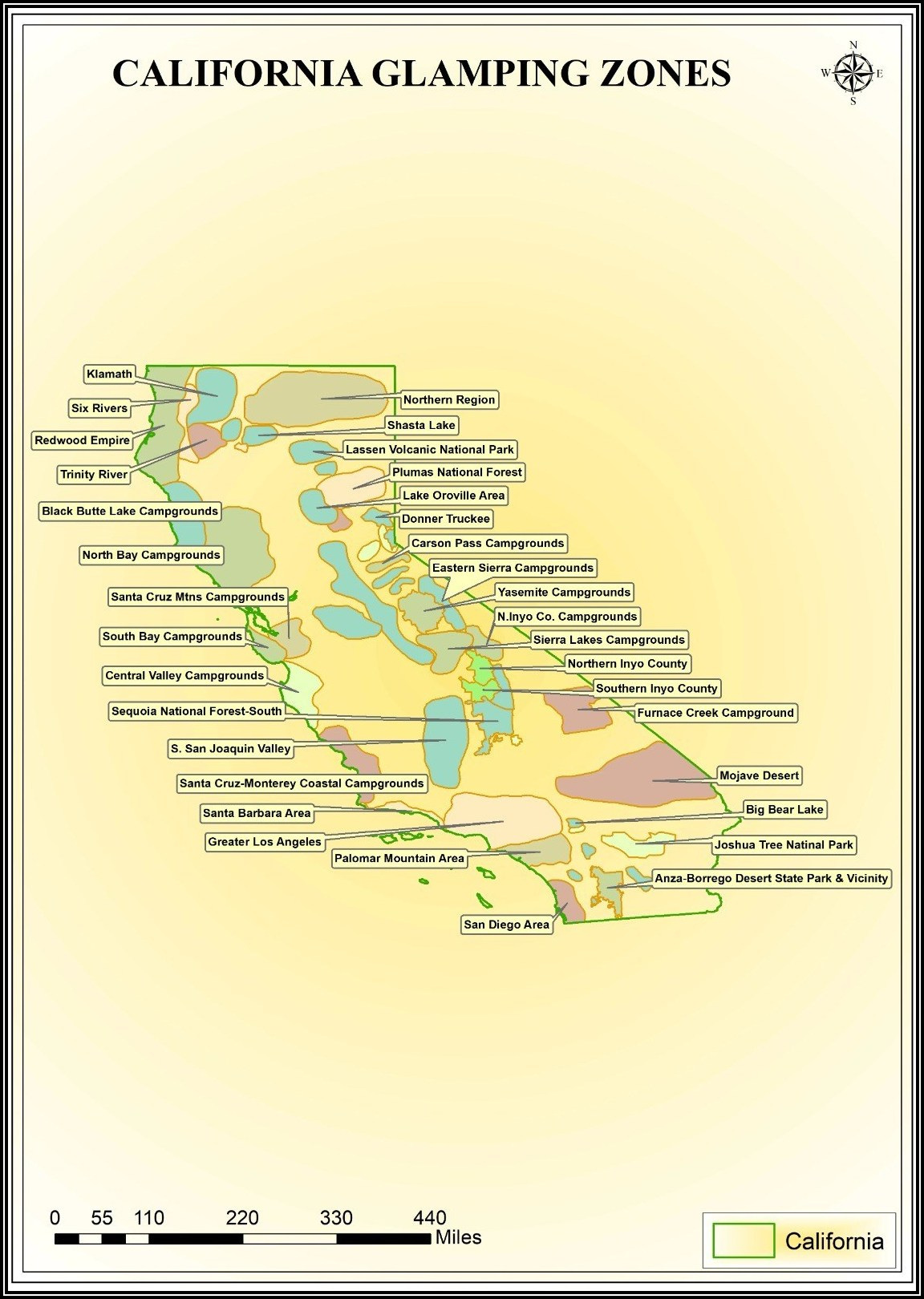 Tourism & Recreation
California Glamping Zone Identification
Tourism Development Board
Mapping and analysis of potential 'glamping' zones in California based on scenic beauty, accessibility, and local regulations.
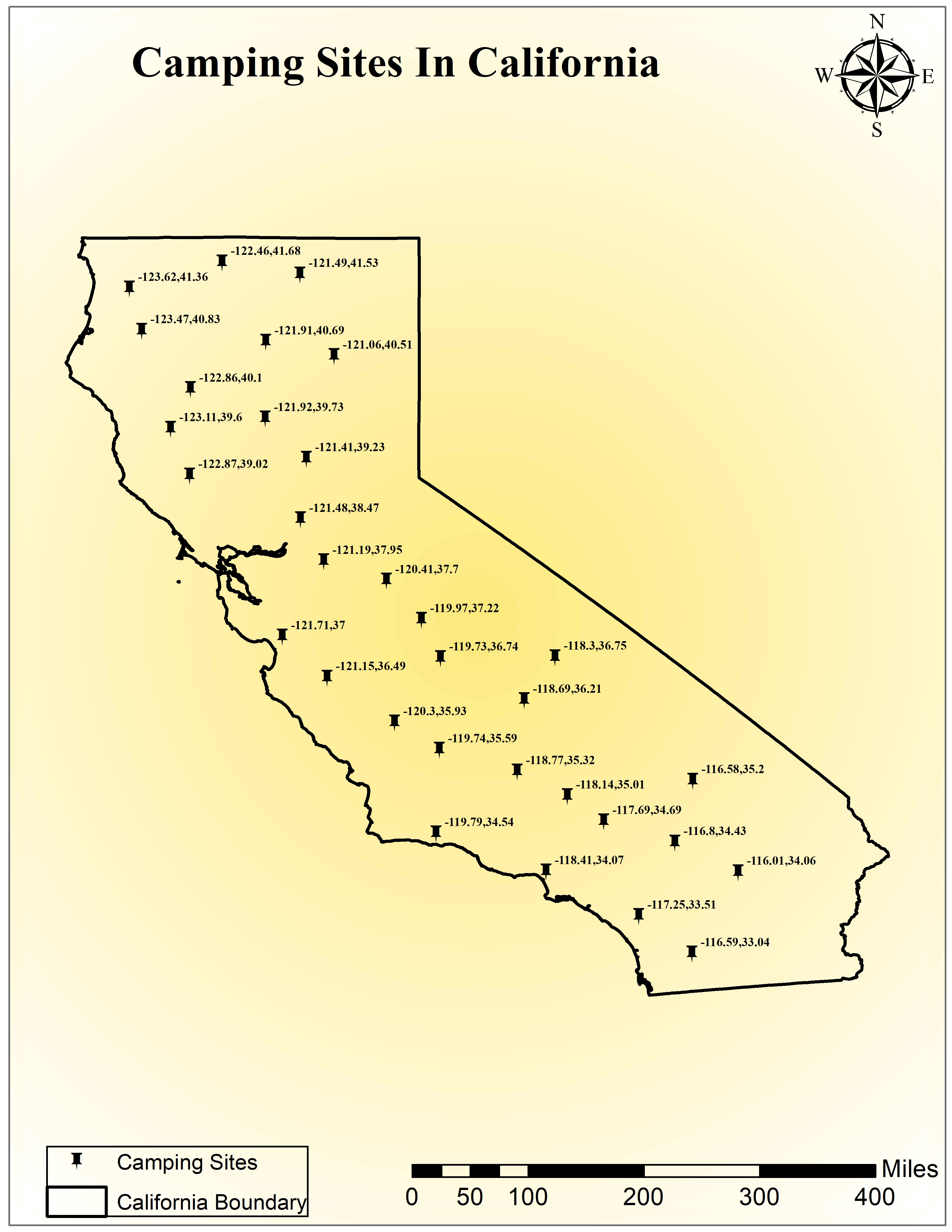 Tourism & Recreation
California Camping Sites Directory
California Parks Association
A comprehensive, interactive map of all registered camping sites in California, including amenities and accessibility information for tourists and residents.