
Showcasing Our Best Work
Explore our extensive portfolio of GIS, cadastral, and digitizing projects. Discover how our cutting-edge mapping solutions empower organizations worldwide with actionable spatial intelligence.
Spatial Analysis
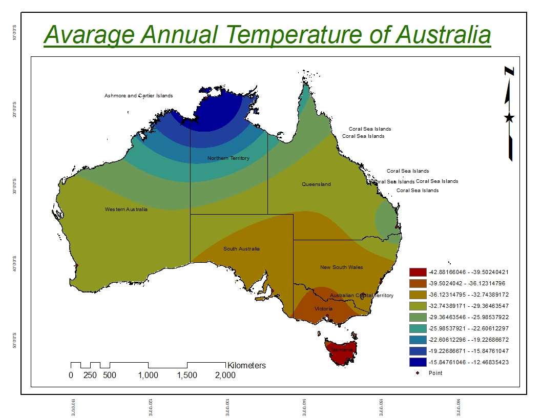
Australia Heat Map
A continent-wide heat map visualization for Australia displaying the spatial intensity of a selected variable — such as temperature, population density, or incident frequency — across the Australian landscape. The kernel density surface is rendered using a warm-to-cool color ramp to clearly communicate concentration gradients from high-intensity coastal urban clusters to the sparse outback interior. State and territory boundaries are overlaid to provide regional administrative context. This heat map is used in environmental monitoring, demographic research, and national infrastructure planning.
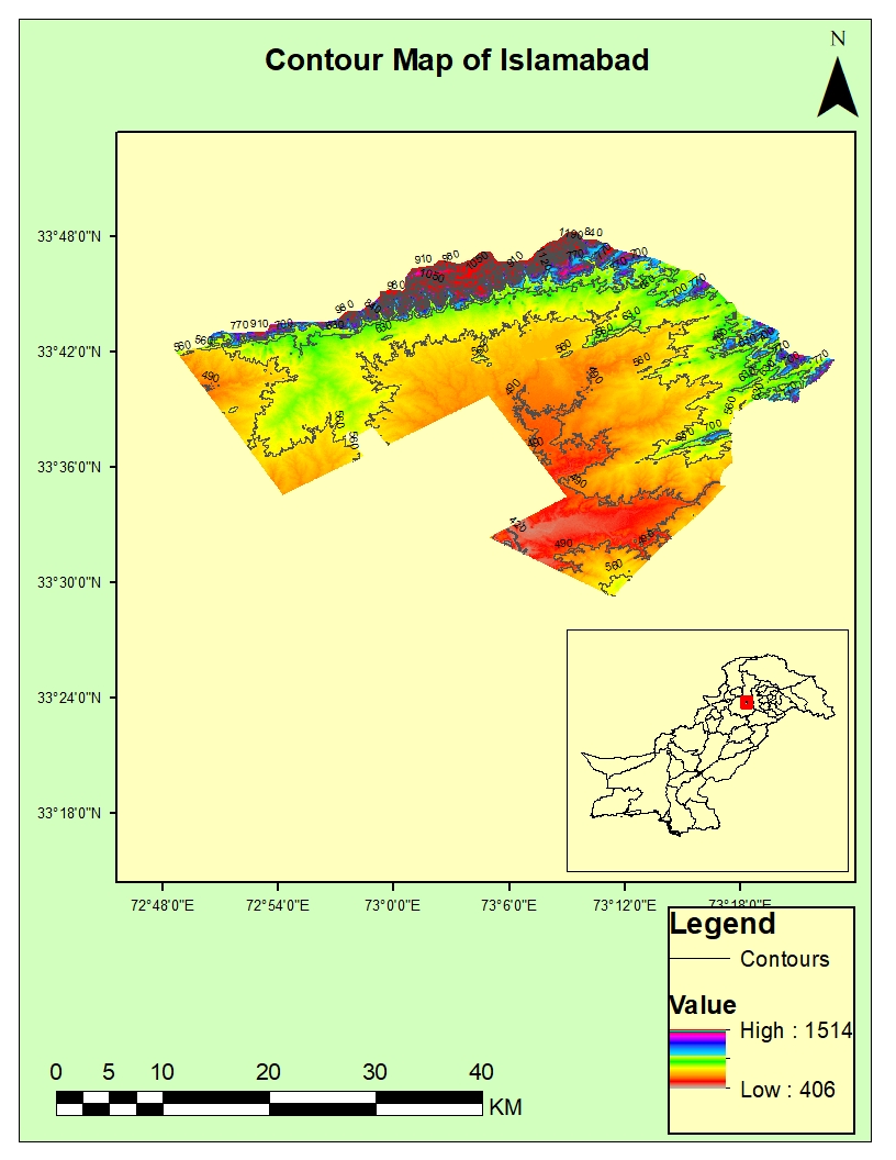
Contour Map ISB
A topographic contour map of the Islamabad Capital Territory derived from digital elevation model (DEM) data, displaying elevation lines at regular vertical intervals. The Margalla Hills range is prominently featured with tightly packed contours indicating steep terrain, while the flat urban plain of Islamabad is represented by widely spaced lines. Contour labels and index lines help users read elevation values and calculate slope gradients across the territory. This map is used by urban planners, civil engineers, and environmental scientists for terrain analysis and site suitability studies.
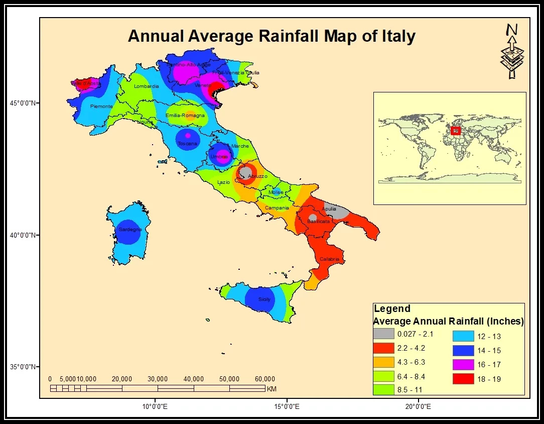
Average Rainfall Italy
An annual average rainfall map for Italy produced from long-term meteorological station records interpolated into a continuous spatial surface covering the entire peninsula and islands. Color gradients from dry yellows and oranges in the southern Mediterranean regions transition to deep blues in the wetter Alpine north and Apennine mountain zones. Regional rainfall statistics are summarized for each province to support agricultural yield forecasting and water resource management. The map provides a critical input for hydrological modeling, irrigation planning, and climate impact assessments in Italy.
Cadastral Mapping
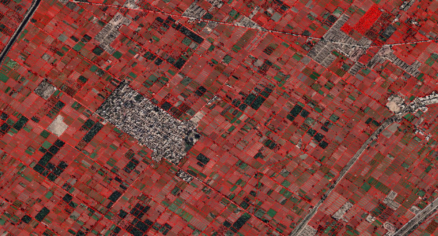
Digitization Of Farm Lands And Urban Areas
A cadastral digitization project converting satellite and aerial imagery into precise vector land parcel boundaries for official land record systems. High-resolution imagery was used as a reference base for manual and semi-automated digitization of property boundaries at the plot level. Each digitized parcel is attributed with ownership metadata, plot numbers, and area calculations for integration into land information systems. The project contributes to transparent land governance and supports property tax assessment, dispute resolution, and urban planning.
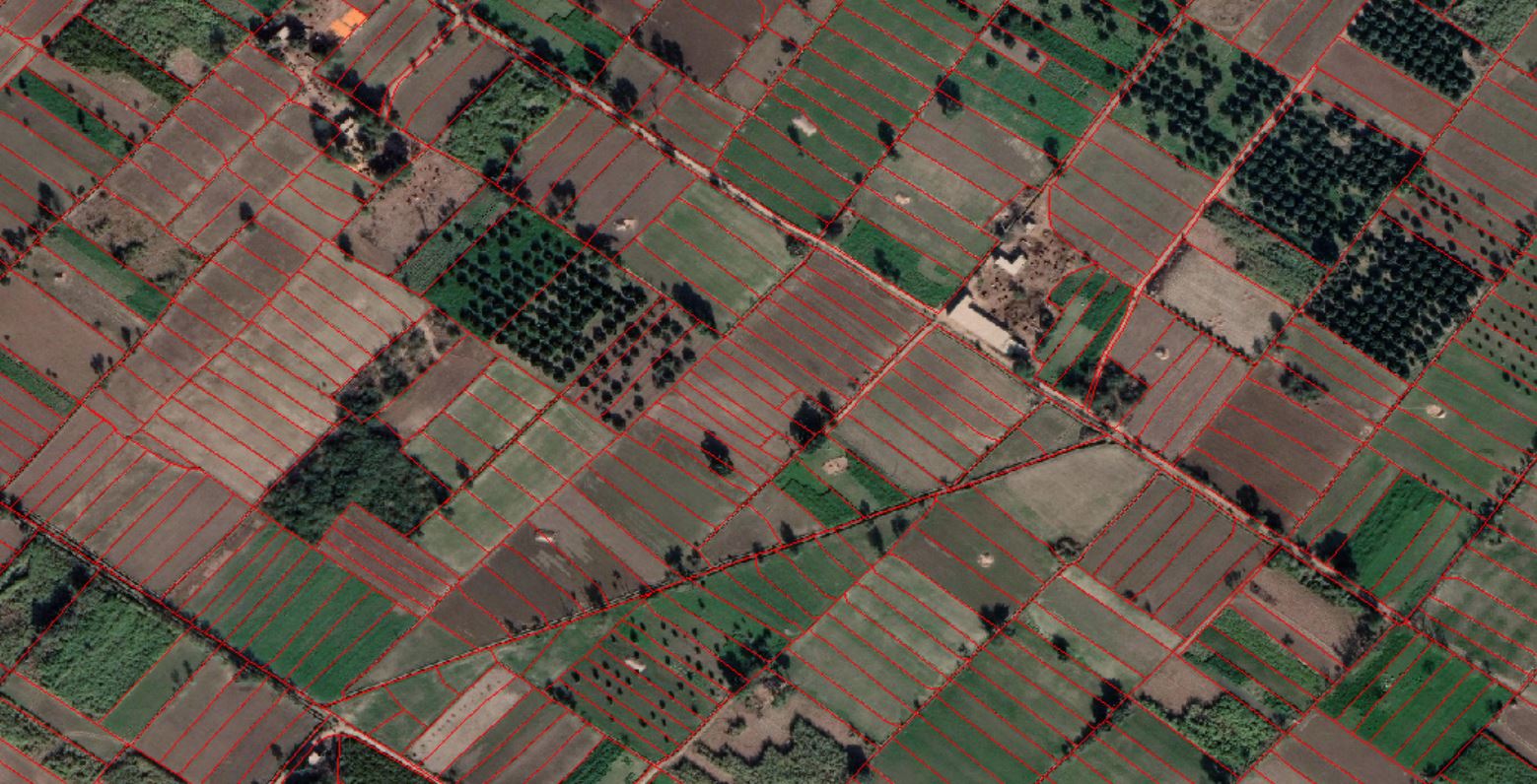
Agricultural Boundary Mapping
A high-resolution agricultural land boundary mapping project using satellite imagery to precisely delineate field parcels and farm boundaries at the village and tehsil level. Each agricultural parcel is digitized with attribute data including crop type, land use classification, and ownership information sourced from field surveys. The resulting vector dataset supports precision agriculture, irrigation planning, and government land record modernization initiatives. Spatial accuracy was maintained through ground control points and quality assurance checks against cadastral survey records.
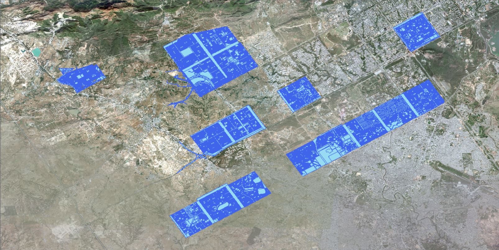
Cadastral Mapping of Capital City
A comprehensive cadastral mapping project for a national capital city, producing a detailed digital land parcel database from existing paper records and satellite imagery. Urban plot boundaries, public spaces, road reserves, and infrastructure corridors are mapped at a high spatial resolution to support city-wide land administration. The digital cadastral dataset is integrated with the city's land information system to enable e-governance services including online title registration and property valuation. This project significantly reduces manual processing time and improves the accuracy of land ownership records.
Interactive Mapping
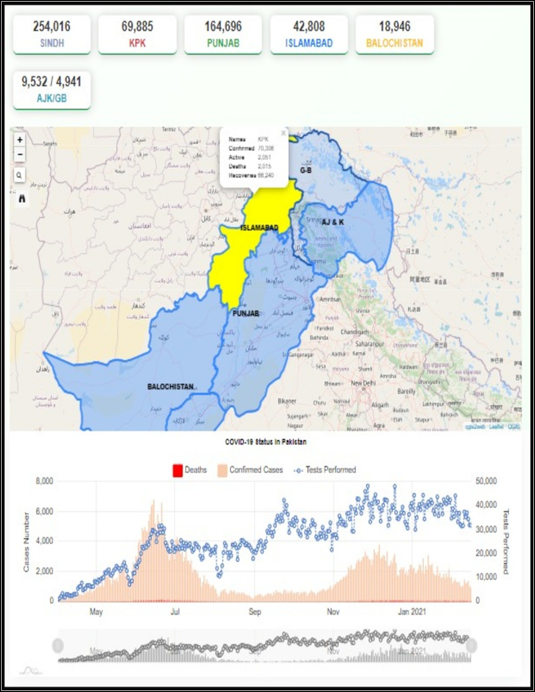
Covid Dashboard
A comprehensive COVID-19 data visualization dashboard featuring multi-line trend charts tracking deaths, confirmed cases, and tests performed over time. The dashboard integrates time-series graphs with spatial data to provide a clear overview of pandemic progression. Color-coded indicators and interactive filters allow users to explore data by date range and region. Real-time data feeds ensure the most up-to-date epidemiological statistics are always displayed.
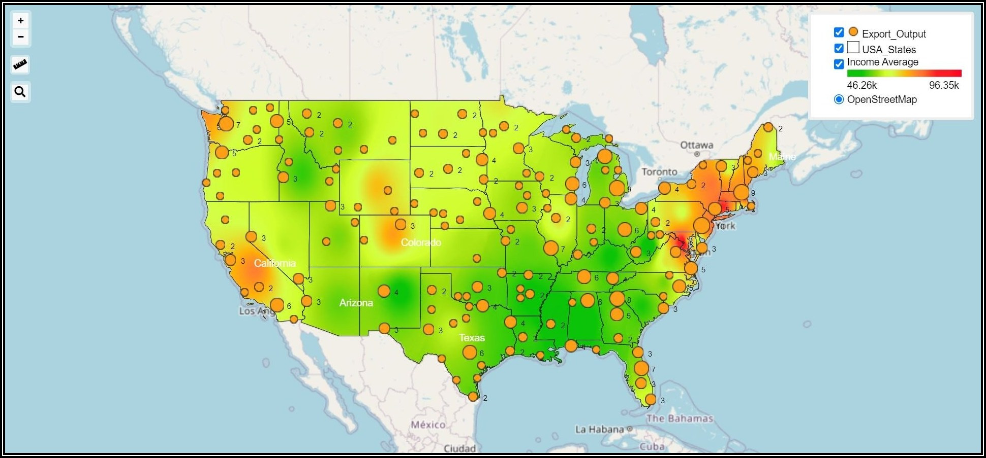
Income Based Described Map USA
A choropleth web map illustrating income distribution and economic disparity across the United States at the county and state level. Color gradients represent varying income brackets, helping policymakers and researchers identify high- and low-income regions at a glance. The interactive layer controls allow toggling between median household income, per-capita income, and poverty rate datasets. Built on a scalable GIS web framework capable of rendering large demographic datasets efficiently.
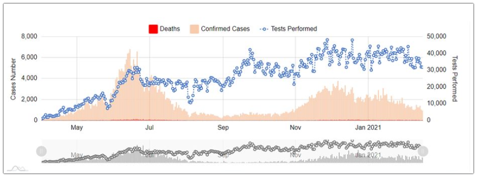
COVID-19 Multi-Series Trend Analysis
An analytical COVID-19 mapping project presenting multi-series trend data including deaths, confirmed cases, and test volumes plotted over a six-month period. The chart overlays three distinct data tracks — bar charts for deaths, area fills for confirmed cases, and scatter plots for tests performed — enabling comparative analysis in a single view. Temporal filtering allows users to zoom into specific outbreak periods for granular insight. This visualization supports public health decision-making by revealing the correlation between testing rates and case surges.