MAPIT – Precision Mapping, Smarter Decisions
Empowering land management, urban planning, and infrastructure development with advanced GIS and cadastral mapping solutions — delivering clarity, accuracy, and insight for smarter choices.
Our Latest Projects
Explore our cutting-edge solutions spanning environmental monitoring, urban planning, and climate analysis powered by advanced AI technology.
Web GIS
Interactive web mapping and spatial data visualization for modern GIS applications.
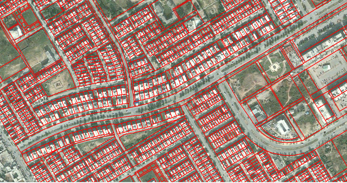
Digitizing
Digital conversion of maps and spatial features for efficient geodata management.
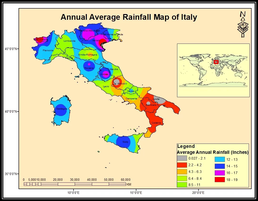
General Mapping
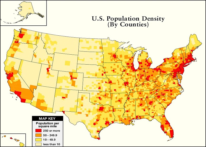
Our recent projects in general mapping include Italy Annual Rainfall Mapping, UK Housing Price Index Heatmap, and California Glamping Zone Identification.
Agricultural Monitoring
Crop health analysis and precision farming solutions to maximize agricultural productivity and efficiency.
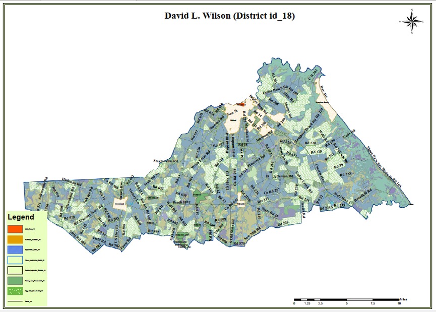
Urban Planning Solutions
Smart city mapping and infrastructure development planning to optimize urban growth and sustainability.
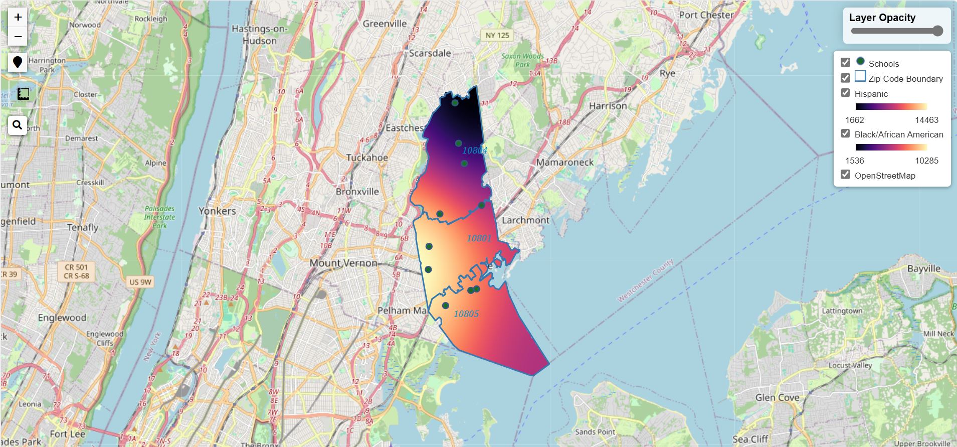
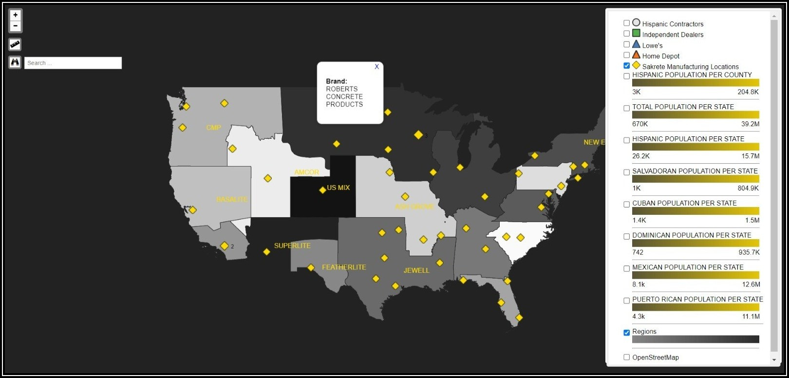
Interactive Map
Discover real-world geospatial data and insights with our live interactive map. Explore locations, analyze spatial relationships, and experience the power of modern web GIS technology.
- Real-time map interaction
- Zoom, pan, and explore features
- Custom layers and overlays


Transforming data into intelligence
Comprehensive geospatial solutions powered by cutting-edge technology and decades of expertise in spatial data analysis and visualization.
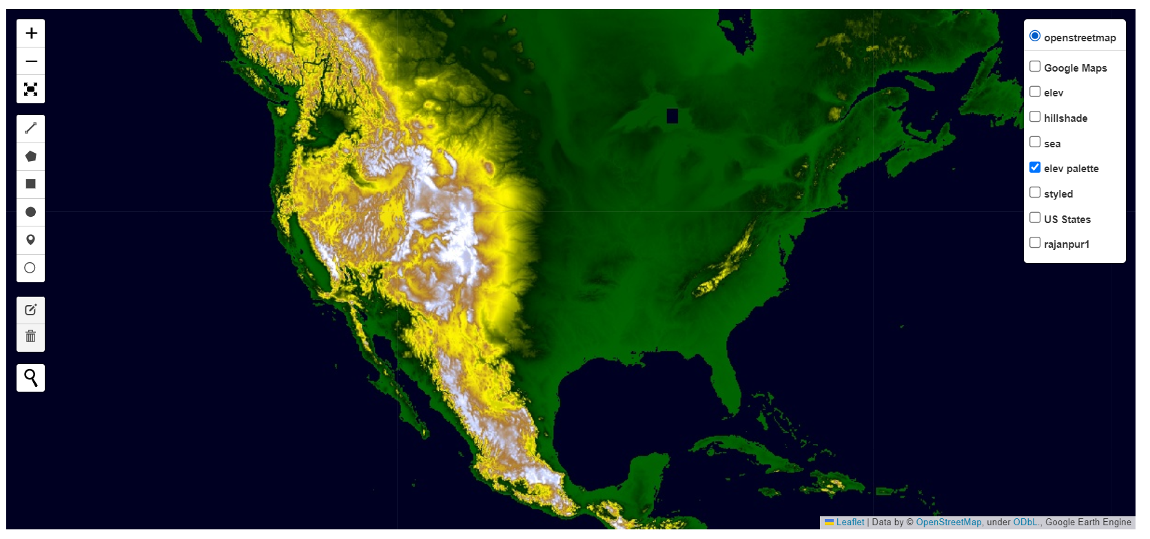
Digital Mapping & Cartography
Professional mapping solutions with real-time data integration for comprehensive spatial visualization and analysis.
Satellite Data Processing
Advanced satellite imagery analysis and earth observation services for environmental and agricultural monitoring.
Environmental Monitoring
Monitor environmental changes using remote sensing technology and predictive analytics for sustainable planning.
Spatial Analytics
Transform complex geospatial data into actionable business insights with advanced analytics and machine learning.

Transform your GIS workflows
Unlock the power of accurate cadastral data and efficient digitization. Join organizations worldwide who trust our platform for modern land administration and web GIS access.